A Curious Stone on Lot 5
At the Oak Island research centre, Rick Lagina and his brother Marty gathered with the team to examine a puzzling discovery made just weeks earlier on Lot 5: a man-made stone feature that immediately raised questions.
Gary Drayton had been metal detecting in the area when he and another team member stopped in their tracks. The stone did not look natural. Its placement felt intentional, and its surroundings suggested human involvement rather than random geology.
Rick summed up the mood bluntly: what lay before them was curious—and potentially important.
![The Curse Of Oak Island | Season 13 Episode 2 Preview [HD] [2025]](https://i.ytimg.com/vi/bJDo25TVNws/hq720.jpg?sqp=-oaymwEhCK4FEIIDSFryq4qpAxMIARUAAAAAGAElAADIQj0AgKJD&rs=AOn4CLB_nVakM6cE9yBj1-Wv9VMiq6JV1w)


A Standing Stone That Should Not Exist
To better understand the feature, archaeologist Laird Niven created a detailed 3D model using drone photography. Flying at multiple angles and elevations, Laird captured hundreds of images and reconstructed the site digitally, much like a medical CT scan.
The model revealed something striking. A narrow, upright stone had been set into the ground like a standing marker. Beside it lay a much larger boulder, carefully positioned and supported by surrounding rocks.
According to Laird, this configuration could not have occurred naturally. A hole had been dug, the stone placed deliberately, and then stabilised with additional rocks.
The scientific conclusion was clear: the boulder had been intentionally set in place by human hands.
Marker or Cover Stone?
For Marty Lagina, that left only two realistic possibilities. Either the stone was placed to conceal something beneath it—or it served as a marker of significance.
Excavation beneath the boulder uncovered dark, organic soil, unlike the surrounding ground. As the material was carefully removed, the team found a single fragment of wood, now sent away for radiocarbon dating.
The results of that test, the team agreed, could be crucial in identifying who was active on Lot 5—and when.
Roman or Viking Origins?
Surveyor Steve Guptill added a compelling historical dimension to the discussion. After reviewing older survey data, he noted that the structure was unlike most features previously documented on the island.
To find comparable formations, he had to look far back in time. Similar stone markers, Steve explained, were commonly used by the Romans and later by the Vikings.
Such markers served two main purposes: as distance or route indicators along roads, or as land-claim symbols. Roman markers, in particular, were used to declare ownership—essentially stating, “This land is ours.”
The implication was sobering. If this stone dated back hundreds or even thousands of years, it could radically alter the known history of Oak Island.
Coins, Crosses, and an Old Theory Resurfaces
The mystery deepened when the team considered nearby finds. Six Roman coins had already been discovered within 250 feet of the stone.
Doug Crowell pointed out that Viking settlement sites across Europe often contained Roman coins, especially in areas later associated with Knights Templar movement.
That connection echoed the team’s 2023 trip to Iceland, where they investigated theories suggesting Viking and Templar cooperation. At those sites, they saw Roman coins and distinctive cross carvings—matching both the coins found on Lot 5 and the 14th-century cross discovered earlier at Smith’s Cove.
The parallels were difficult to ignore.
Orientation to the North
Another critical detail emerged when Marty asked about the stone’s orientation. Steve confirmed that the marker faced north.
Historically, marker stones were placed in clear lines of sight, allowing one to see from one marker to the next. If this was true, then logic dictated there should be another marker somewhere along the same axis.
Steve surveyed the stone’s face and projected its directional line across the landscape. So far, nothing had been identified—but the absence of evidence did not rule out its existence.
The team agreed on the next step: walk the line.
Walking the Line Into the Woods
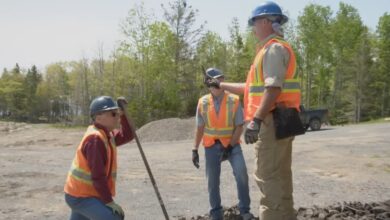
The following day, the team returned to Lot 5. Using a total station—ground-based surveying equipment ideal for dense forest—Steve established a perfectly straight control line extending southeast from the stone.
As the group advanced, Steve and Peter cut a path through thick woods, while Gary swept the ground with his metal detector along the projected route.
If this line truly held significance, any artefacts found along it could help determine who had walked it centuries ago—and why.
A Small Find With Big Implications
Before long, Gary’s detector sounded off near the line. The target turned out to be a thin iron strap with a square hole, possibly part of a barrel loop.
While small, the find was intriguing. Similar iron straps had previously been linked to barrels believed to have held valuable contents.
The object was carefully bagged and sent to the lab for further analysis.
More Questions Than Answers
As the team continued along the line, one thought lingered heavily in Rick Lagina’s mind: how many similar structures might still lie hidden beneath the forest floor?
How many markers, pathways, or clues had been walked past over the years without being recognised?
For Rick, the true value of the Lot 5 stone was not just what it might point to—but what it revealed about how much of Oak Island’s story may still be undiscovered.
With tools in hand and a line to follow, the team prepared to see where it might lead next.